Bryce renders terrain images using greyscale to height maps (G2H), where black and white represent the lowest and highest elevations, respectively. The two black and white images below are examples.

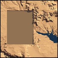
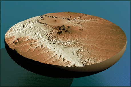
I downloaded DEM files (Digital Elevation Model) from the USGS website. Each file depicted a 1°by 1° piece of the United States. Due to curvature of the Earth, and the necessary squashing flat of it, these pieces would not line up in Bryce. I had to bring thirty of these into Photoshop and composite them into one big G2H. Back in Bryce, it became Project Powell, my first big geographical image. It represents, approximently, a 6° by 5° chunk of the Earth, about 300 miles wide!

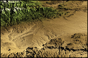
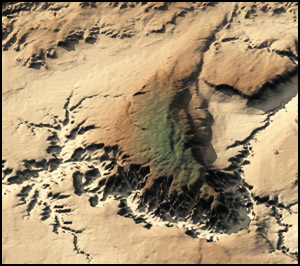
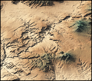
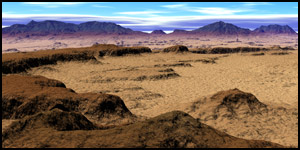
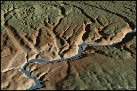
Note: the colors in these images only mimic the actual landscapes out there: it's all a convenient illusion. They're carefully adjusted Bryce materials, showing lighter tones in the lower regions, often deserts, through brown and green in the higher elevations. Getting these materials and textures correct is critical to making the images work visually. Also, there is definitely vertical axaggeration, my guess is that everything is twice normal height. I can't remember is I did it, or if that's just the way things got imported. Looks Good, though!

Bryce USGS Projects

Project Powell DEM
Project Powell DEM Detail
Bryce Construction
Project Powell Detail - Grand Canyon
Project Powell Detail - Canyonlands
Project Powell
The DEM files were great for showing a huge area, but the detail was limited. A solution was found in a different type of file format, SDTS (Spatial Data Transfer Standard). Each download represented about six by nine miles of land. When I had figured out how to uncompress and unpack the data, and then which part of it went into Bryce, the next project began.

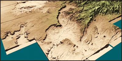
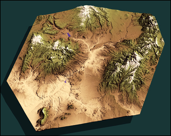
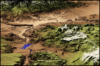
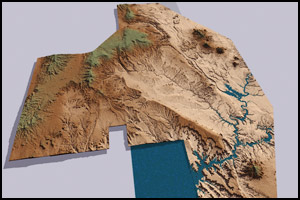
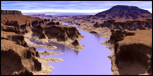
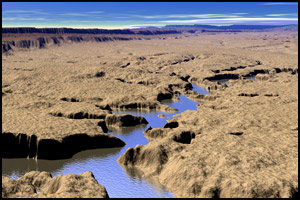
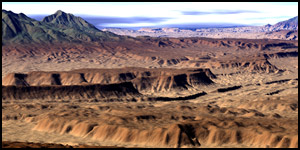
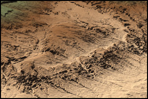
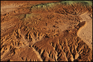
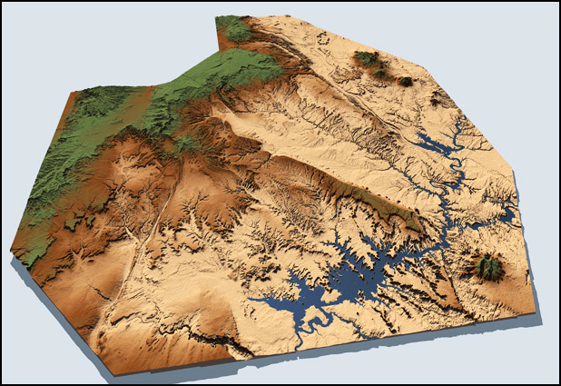
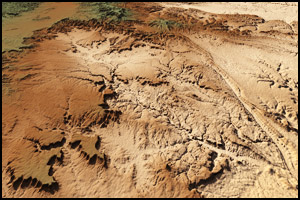
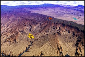
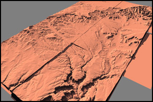
I called it The Circle Cliffs Project, after an area near to Utah's Henry Mountains, where it all started. Eventually it grew huge, over 100 terrains all carefully lined up. After rendering in Bryce, all of the visible seams had to be retouched in Photoshop. The project stretches from the Henry Mountains in the upper right to Navajo Mountain in the lower left. Top Center is Boulder Mountain, and the Kaiparowits Plateau runs down the left side. The large drainage into Lake Powell, just left of center, is the watershed of the Escalante River.

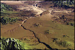
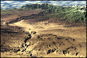
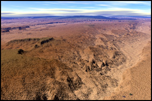
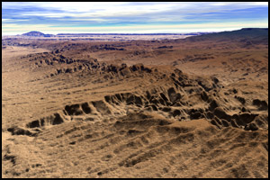
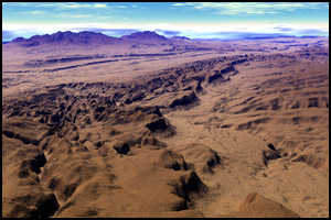
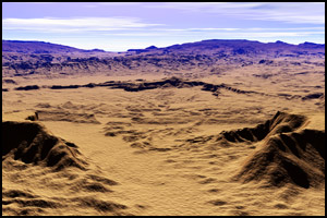
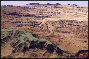
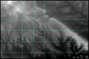
There was so much detail in the project that I could carefully position cameras inside it, resulting in views you might see in a flyover at a few miles altitude.

West Annex Construction
Missing Piece Bryce DEM
Circle Cliffs Bryce Project
Lake Powell Bryce
Escalante River Bryce
Deer Point Bryce
Circle Cliffs Bryce
Caineville 2 Bryce
Deer Point Bryce
I was very satisfied with it all, but I could not help myself, making another gigantic addition to the western edge of Circle Cliffs. After all, I couldn't leave Lake Powell half done, and the land forms westward to Bryce Canyon were calling. What's another fifty terrains, anyway? The new total came to over 160 SDTS downloads. I called the new addition West of Escalante.

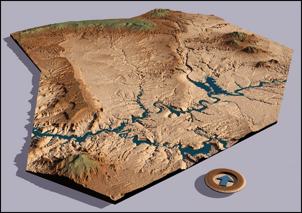
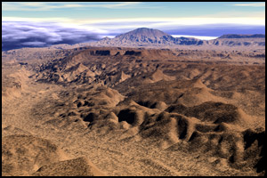
As I built westward, I found a dismaying thing: two of the needed downloads were not available! I ended up filling the holes with carefully sliced out pieces from the larger, lower resolution 1° DEM map. Lucky for me, they both occupy lower and flatter areas, and it's hard to spot them. I also ran into a few glitches in the data which required lots of Photoshop post processing to cure.

Capitol Reef Bryce
Fruita Bryce
Caineville Bryce
Capitol Reef National Park
Kaiparowits Plateau
Bryce West of Escalante
Paria River Bryce
Kaiparowits Plateau Escalante SpaceBugs Bryce
Cerrillos Hills Bryce
Rio Grande Bandelier Bryce
Lae Superior Shore Bryce
Next came smaller projects. Some friends were living along in Minesota, northeast of Duluth, so I tackled the Lake Superior shoreline, and discovered that mountainous topographies made much more interesting subjects. My hope to relocate to New Mexico pruduced two images. First was the Cerrillos Hills. It's composed of only four SDTS downloads, and with the Cerrillos hills exactly at the center, it was a challenge to get the pieces lined up well. The other image, also composed of four downloads, shows a stretch of the Rio Grande where it passes Bandelier National Monument.
West of Escalante Bryce Fix
DEM Bryce Patches
There was one last big project. When I was determined to move to Santa Fe (two friends had done it already), I stitched 176 (!) terrains together to make The Santa Fe Project. This one brought my old computer to its knees, and my 2016 computer is huffing and puffing a bit with these new renders too.

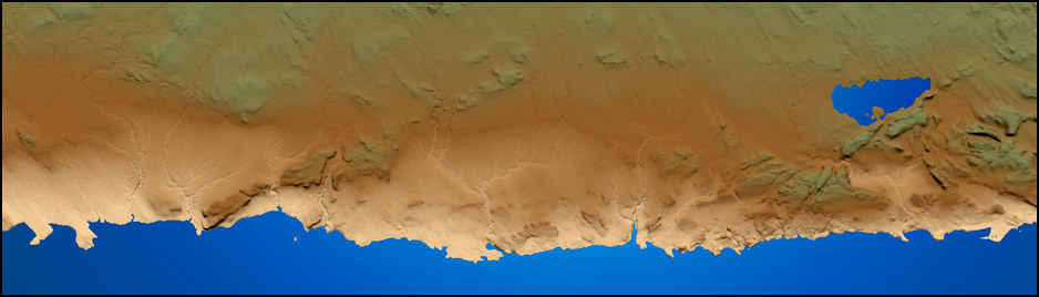
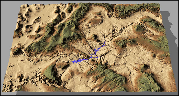
The "as the crow flies" distance between Albuquerque (bottom left) and Taos (top right) is about 110 miles.

Santa Fe Project  Bryce
SpaceBug Pojoaque Bryce
Georgia O'Keeffe Country
Taos Looking South Bryce
Cochiti to Taos Bryce
Santa Fe Area Bryce